
Aerial maps got more visual and immersive with a brand new 360° mapping technology developed by the start-up Globalvision from Geneva.
Globalvision’s new solution enables the user to virtually fly 100 meters above the ground, turn all around the scenes and to move to dozens of scenes just as if they were birds. Many wikipedia-sourced articles enhance the platform and give more information on particular buildings and elements around.
GlobalVision Communication is the Swiss company who originated this project. It specializes in 360° immersive technologies and offers full-range of immersive video and streetview mapping. The company is an official Google Business View partner and 360° mapping solution provider.
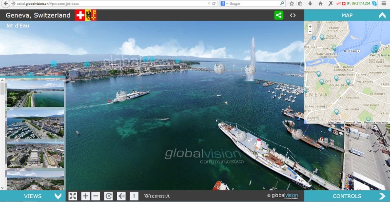
“We are an award-winning company, offering unique services for companies and industrial facilities. 360° panoramic imagery is a booming sector in which we have gathered more than 15 years experience and a unique insight. To satisfy our customers demands, we are driving our own R&D efforts from our two offices in Europe and Asia”, said Jan-Mathieu Donnier, GlobalVision CEO.
The company serves industry leaders, such as Mozilla foundation, Google Business Photos, and numerous industrial and commercial partners across Switzerland and worldwide (Citroën, Firmenich, Nestlé, etc.), as well as large-scale public services companies and public institutions for urban development, industrial safety and environmental care.










Please login or sign up to comment.
Commenting guidelines